


This WP is dedicated to the validation of numerical models at the data resolution provided by WP1 and to quantify the effect of epistemic uncertainties linked to ignorance of the model parameters at a resolution finer than observed or inversed data. The numerical models are then used to predict future events. The output of this WP are spatio-temporal waveforms to be used for the structural analysis in WP 3 and a metamodel that can be used to derive probabilistic ground motion maps for risk assessment in WP 4.
Validation of numerical models at low frequency
This task is dedicated to the validation of the numerical simulations below 1 Hz for moderate magnitude earthquakes that does not generate nonlinear soil behavior at the site of study (i.e., acceleration peak ground motion < 50 m/s/s). In this frequency range, the deterministic input parameters of the simulations are given from the inversion of data. We intend to check the validity of our numerical simulations at different sites already instrumented. The data are open access for these sites. The numerical simulations tools will be the code EFISPEC3D and the code SPECFEM3D for computing the wave propagation from the source to the site. Generally, the models generated by inversions are based on the assumption of 1D geometry and they will be implemented as it is in the 3D numerical methods. The validation of the models will be done on a set of earthquakes (whose source mechanism is known) recorded on the Argostoli’s temporary accelerometric network.
Full numerical inversion exercise
Moreover, we will conduct a full numerical inversion exercise in order to comfort the results obtained in WP1. This task consists in generating random soil media, performing forward simulations in these media and inverting back the media from these simulations. The inversion results from this exercise can be compared the input.
Nonlinear 2D FEM Analysis (code_aster) to assess basin amplification
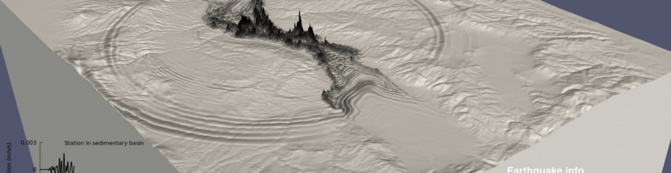
The 3D spectral-element models are validated for low strains and simulation are performed with linear elastic soil behavior. However, it is well known from former analysis (e.g. NERA) that nonlinear soil-behaviour can have a significant impact on site response when considering strong motion events. The linear analysis generally overestimates the site amplification. This will be assessed qualitatively for a simplified 2D model of the Grenoble basin using the Iwan constitutive model. The spatial variability at local scale (within the basin) will be modelled by velocity random fields with parameters coming from WP1, as explained above.
Scenario earthquake simulations for Grenoble basin accounting for epistemic uncertainties and aleatory variability.
To address epistemic uncertainty we will generate multiple stochastic kinematic rupture based on Mai and Beroza (2002) earthquake slip model. We will target three faults with different size that correspond to magnitude (Mw) 4, 5 and 6 considering the uncertainty on final slip displacement (including the slip rate or other factor would drastically increase the number of 3D simulations to be done and is not foreseen here). Concerning the random variability of the medium at local scale, we will use Karman or Gaussian correlation models and Karhunen Loeve expansion to represent the velocity random fields. The parameters of these random fields (correlation length and coefficient of variation) at local scale, i.e., within the basin, will be chosen in agreement with the results of WP 1 and literature. In order to reduce the computational cost and to allow for sensitivity analysis, we will construct a so-called metamodel, that approximates the response quantities of interest as a function of the uncertain input parameters (fault rupture, stratification, variability). For this purpose, spectral methods (Polynomial chaos expansion) will be implemented by adequately choosing a reduced number of model runs. The modelling results will be compared to actual ground motion variability observed by the French accelerometric network and two seismological stations that will be specifically deployed within this project at the location of the hypothetical infrastructure systems in WP 4. Eventually, this task is also dedicated to the comparison of spatial correlation and coherency functions derived from observed and simulated seismograms to the models available in the literature. In addition to the output used within this project, it is expected that the analysis conducted in this WP will provide useful insights in the impact of fault, epistemic uncertainty and local soil spatial variability in 3D site response analysis. These results should be documented as recommendations for future studies.
Dernière mise à jour le 28.02.2018